
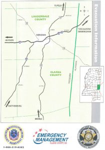
FLOODWARNING SYSTEM
Lauderdale County has developed a flood warning system. Warnings will be disseminated by radio, TV, weather radio, and by sheriff and volunteer fire services equipped with public address systems. The flood warning system is intended to up to one hour advance warning of a flood hazard. For warning information, tune to radio stations: WALT, WEXR, WMER, WMAW, WJDQ, WJXM, WKZB, WNBN, WMSO, WFFX, WMLV, WMOX, WOKK, WYHL, WSLY, JACK FM, WZKR OR WZKS, or set your television channel on WGBC, WMDN-TV 24, WTOK-TV, FOX 30, MyTOK 2, Meridian CW8, WMDNB (Bounce), WMDNC (Cozi) or Comcast TV.
- FLASH FLOOD WATCH means that flash flooding is possible within the watch area.
- FLASH FLOOD WARNING means that flash flooding is imminent or has been reported in the warning area.
“Noah listened....Will you?...Get flood insurance.”
Flood Safety Tips (in case of a flood):
- Keep your waterway and ditches clean.
- Stop illegal dumping in creeks/water drains.
- Shut off the electrical power. With the possible exception of your refrigerator, turn of all circuits at the breaker box. This will greatly reduce your risk of electrocution.
- Do not walk through flowing water. Six inches of rapidly flowing water can knock a person off their feet.
- Look before you step. When walking through standing water, use a pole or a stick to ensure there is still firm ground to step on.
- Do not drive through a flooded area. The water may be deep enough to float your vehicle off the road. Drowning is the number one cause of flood deaths. More people drown in their cars than anywhere else.
- Do not use an open flame to inspect damages. Use a flashlight where there are known gas lines. A candle, lantern, or even a cigarette lighter can cause an explosion if there is gas.
- Stay away from power lines. Electrocution is the number two cause of death during a flood. Report downed power lines to Ms. Power 1.800.487.3275 and EMEPA 601.581.8600.
- Look out for animals. Many animals will be flooded out of their homes and will seek shelter anywhere they can. Use a stick to turn over debris very carefully. Animals will be frightened and may attack if alarmed.
- Pets should be provided for, as public shelters will not allow them.
- Use caution when reentering a building. Before entering a building, cautiously check for any structural damage. Many people are injured due to unsafe buildings after a storm.
- Always think before acting.
River Data and Current Weather Updates
National Weather Service
The National Weather Service monitors river stages and issues updates and flood warnings as necessary. For more information, click here.
Go to AccuWeather.com for Meridian, MS for local weather.
National Flood Insurance Program
The Federal Emergency Management Agency (FEMA), manages the National Flood Insurance Program. The three components of the National Flood Insurance Program (NFIP) are:
- Flood Insurance
- Floodplain Management
- Flood Hazard Mapping
Nearly 20,000 communities across the United States and its territories participate in the NFIP by adopting and enforcing floodplain management ordinances to reduce future flood damage. In exchange, the NFIP makes Federally backed flood insurance available to homeowners, renters, and business owners in these communities. Community participation in the NFIP is voluntary.
For more information on the National Flood Insurance Program visit either the FEMA NFIP website or Floodsmart.gov.
Mandatory Purchase Requirement
The mandatory requirement applies to all forms of federal or federally related financial assistance for buildings located in a Special Flood Hazard Area (SFHA). This requirement affects loans and grants for the purchase, construction, repair, or improvement of any publicly or privately owned building in the SFHA, including machinery, equipment, fixtures, and furnishings contained in such buildings. Financial assistance programs affected include loans and grants from agencies such as the Department of Veterans Affairs, Farmers Home Administration, Small Business Administration, and Federal Emergency Management Agency. The requirement also applies to secured mortgage loans from financial institutions, such as commercial lenders, savings and loan association, savings banks, and credit unions that are regulated, supervised by Federal agencies such as the Federal Deposit Insurance Corporation and the Office of Thrift Supervision.
How MPR Works
Before a person can receive a loan or other financial assistance from one for the affected agencies or lenders, there must be a check to see if the building is in a Special Flood Hazard Area (SFHA). The SFHA is base (100 – year) floodplain mapped on a Flood Insurance Rate Map (FIRM). It is shown as one or more zones that begin with the letter “A” or “V.”
Copies of the FIRM are available for review in the Permit Office at the 2525 14th Street in Meridian, Mississippi.
Many lenders and insurance agents also have copies. It is the agency or lender’s responsibility to check the FIRM to determine if the building is in an SFHA, although the County of Hinds provides assistance.
If the building is in a SFHA, the agency or lender is required by law to require the recipient to purchase a flood insurance policy on the building. The requirement is for structural coverage equal to the amount of the loan (or other financial assistance) Or the maximum amount available, whichever is less. The maximum amount available for a single-family house is $250,000.
The mandatory purchase requirement does not affect loans or financial assistance for items that are not covered by a flood insurance policy, such as vehicles, business expenses, landscaping, and vacant lots. It does not affect loans for buildings that are not in the SFHA, even though a portion of the lot may be flood prone. While not mandated by law, a lender may require a flood insurance policy as a condition of a loan for a property in any zone on a Flood Insurance Rate Map.
Community Rating System
The National Flood Insurance Program (NFIP) Community Rating System (CRS) is a voluntary incentive program that recognizes and encourages community floodplain management activities that exceed the minimum NFIP requirements. As a result, flood insurance premium rates are discounted to reflect the reduced flood risk resulting from the community actions meeting the three goals of the CRS: (1) reduce flood losses; (2) facilitate accurate insurance rating; and (3) promote the awareness of flood insurance.
For CRS participating communities, flood insurance premium rates are discounted in increments of 5%. A Class 1 community would receive a 45% premium discount, while a Class 9 community would receive a 5% discount. A Class 10 is not participating in the CRS and receives no discount. The CRS classes for local communities are based on 18 creditable activities, organized under four categories:
- Public Information. Credit for advising the public about flood hazard, flood insurance, and ways to reduce flood damage as well as outreach to the public.
- Mapping and Regulations. Credit for regulations that provide increased protection to new developments, mapping areas not shown on the FIRM, preserving open space, enforcing higher regulatory standards, and managing stormwater, among other activities.
- Flood Damage Reduction. Credit for providing a comprehensive floodplain management plan, relocating or retrofitting floodprone structures, and maintaining drainage systems.
- Flood Preparedness. Credit for flood warning, levee safety, and dam safety programs.